 |
Lone-Pine
is a small town located in the high desert country of the Eastern Sierra Nevada Mountains within the Sequoia National Park. It can be reached via Highway 395, and only has one stop light in town, but does have plenty of good restaurants and shopping. The town of Lone Pine is considered the "Gateway to Mt. Whitney," which is the highest peak in the U.S. outside of Alaska at 14,496 feet. If you aren't into mountain climbing (which attracts many people to Lone Pine,) there are plenty of other activities in the area to keep you busy. Mountain biking is popular, as is trout fishing in the pristine mountain lakes and streams, and many dirt roads offer challenging rides for off road vehicles. Other activities near Lone Pine include golf, hiking, hang gliding and nature tours, and the entrance to Death Valley National Park is only about two miles away. There is also an annual film festival in Lone Pine that pays tribute to the history of film making in the area. Other places to explore include the Alabama Hills and various ghost towns - although Mt. Whitney, by far, is the biggest attraction in town. Climbing it isn't for everyone - it is tough, and steep and long, but if you are up for it, the trail is surprisingly accessible and extremely well maintained. However, just visiting and seeing the incredible views of this awesome mountain peak is worth the trip to Lone Pine.

|
Lone Pine Vacation Rentals
|

|
|
|

|
Lone Pine Hotels and Resorts
|

|
|
| | | Hotels & Motels |
| Comfort Inn | 1920 S Main St | Lone Pine, CA | | (760) 876-8700 |

|
Lone Pine Weather & Climate
|

|
|
|
The High Desert Country of the Eastern Sierra Nevada Mountains enjoys a diverse climate in a unique geographical area of the country. The town of Lone Pine, for instance, is near both Death Valley, which is the lowest point in the United States, and Mt. Whitney, which is the highest peak in the lower 48 states. Four seasons with low humidity is the norm for this region. Far from the smog of the valley and cities below, this area of California has bright sunshine and fresh air during the day with brilliant star-filled skies at night. Summer days are generally hot, with occasional high clouds. The rest of the year, temperatures remain mild during the day but evenings can turn quite cold. Rain is minimal with January and February being the wettest months. With such variations in altitude, this region can experience sharp changes in both temperature and precipitation. It's best to remember if it's raining in the valley, it's most likely snowing in the mountains.
|
| Month |
High Temp |
Low Temp |
Rainfall |
Ocean Temp |
| January |
54°F |
27°F |
0.99 in. |
- |
| February |
59°F |
30°F |
1.13 in. |
- |
| March |
65°F |
34°F |
0.73 in. |
- |
| April |
74°F |
40°F |
0.21 in. |
- |
| May |
83°F |
49°F |
0.19 in. |
- |
| June |
93°F |
58°F |
0.18 in. |
- |
| July |
99°F |
63°F |
0.13 in. |
- |
| August |
97°F |
61°F |
0.12 in. |
- |
| September |
89°F |
55°F |
0.26 in. |
- |
| October |
77°F |
44°F |
0.18 in. |
- |
| November |
63°F |
33°F |
0.49 in. |
- |
| December |
55°F |
27°F |
0.59 in. |
- |

|
Lone Pine Map & Transportation
|

|
|
 |
|
|
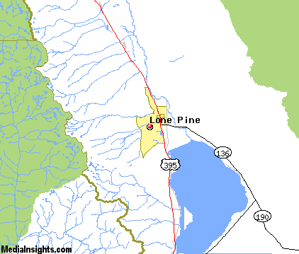
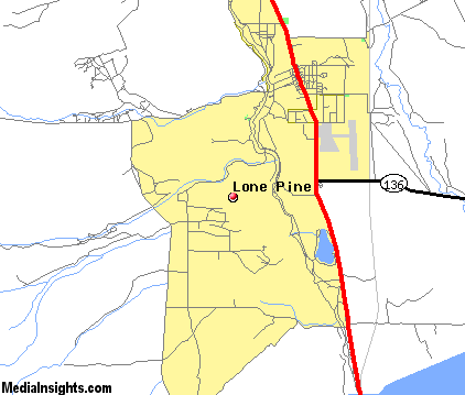
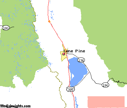
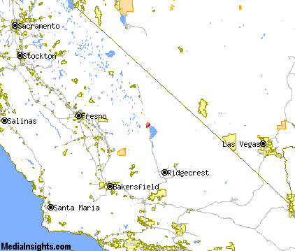
| Click each thumbnail image to enlarge. |
 |
 |
 |
 |
The closest airports in the area are the Eastern Sierra Regional airport (BIH) located about 57 miles northwest of Lone Pine in Bishop, California, the Inyokern airport (IYK) located approximately 64 miles south of Lone Pine in Inyokern, California, the Porterville Municipal airport (PTV) located roughly 66 miles southwest of Lone Pine in Porterville, California, the Trona airport (L72) located around 67 miles southeast of Lone Pine in Trona, California, the Visalia Municipal airport (VIS) located about 74 miles west of Lone Pine in Visalia, California, and finally the Beatty airport (BTY) located approximately 74 miles east of Lone Pine in Beatty, Nevada.
|

|
Lone Pine Attractions
|

|
|
| | | Water Parks |
| Wild Water Adventures | Clovis | CA | 91.3 mi. | | | The Island Waterpark and Family Fun Village | Fresno | CA | 94.3 mi. | |
| | | Golf Courses |
| Mt Whitney Golf Club | Lone Pine | CA | | |
| | | Ski Areas |
| Mammoth Mountain | Mammoth Lakes | CA | 88.8 mi. | | | June Mountain | June Lake | CA | 99.5 mi. | |
| | | Zoos and Aquariums |
| Chaffee Zoological Gardens | Fresno | CA | 94.3 mi. | |
Notice a problem with the information on this page? Please notify us.
|
Disclaimer: We recommend you conduct your own research regarding all accomodations and attractions found on this website. The distances shown on this website are straight-line distances as the crow flies. The road distance may be considerably longer. You assume all liability for use of any information found on this website. No information is confirmed or warranted in any way. By using our services you agree to the terms and conditions of this disclaimer.
|
| We are the #1 site for your California Vacation presenting California vacation rentals, hotels, weather and map for each city. |
California Vacation and Hawaiian Vacation are publications and trademarks of Media Insights, Inc.
©1997-2025 All Rights Reserved.
|
|